Modern commercial agriculture faces a paradox. Global food demand is projected to increase by 50–70% by 2050, driven by population growth and rising incomes in developing markets. Yet the land area available for agricultural production is effectively fixed, input costs — water, fertilizer, pesticides, and labor — are rising, and regulatory pressure to reduce agriculture's environmental footprint is intensifying. Producing more food from the same land, with fewer inputs and less environmental impact, is not an aspiration but an operational necessity for commercial farms that need to remain competitive over the next generation.
Precision agriculture — the application of data and technology to vary inputs across a field at spatial scales small enough to match the actual variation in crop needs and conditions — is the most promising systematic approach to meeting this challenge. And drone technology is increasingly central to precision agriculture's practical implementation, providing the aerial sensing capability to map field variability at the resolution required for effective variable-rate input management, at costs and operational complexity levels that are accessible to commercial farming operations.
Multispectral Imaging and NDVI Crop Analysis
The most widely deployed aerial sensing technology in precision agriculture is multispectral imaging — cameras that capture reflectance in multiple narrow spectral bands across and beyond the visible spectrum. Plant physiology creates characteristic reflectance signatures that reveal crop health and vigor status. Healthy, photosynthetically active vegetation strongly absorbs red light (used for photosynthesis) and strongly reflects near-infrared light (due to the internal structure of healthy leaf cells). Stressed or senescing vegetation absorbs less red and reflects differently in near-infrared, creating measurable spectral differences detectable by multispectral sensors.
The Normalized Difference Vegetation Index (NDVI), calculated as (NIR - Red) / (NIR + Red), is the most commonly used single-value index for crop health assessment. NDVI values range from -1 to 1, with healthy dense vegetation typically producing values of 0.6–0.9, and stressed, sparse, or non-vegetated areas producing lower values. Drone-based NDVI mapping, flown at altitudes of 40–80 meters with multispectral sensors, produces field maps at 3–10cm ground sample distance — fine enough to identify individual plant stress symptoms, disease onset, or stand establishment variability that management at this spatial scale can address.
Beyond NDVI, a library of vegetation indices targeting specific stress indicators and nutrient deficiencies has been developed. NDRE (Normalized Difference Red Edge) is more sensitive to chlorophyll variation than NDVI and therefore more responsive to nitrogen stress. NDWI (Normalized Difference Water Index) uses near-infrared and short-wave infrared bands to indicate crop water content. Combinations of these indices from multi-temporal drone surveys — comparing field maps from multiple points in the growing season — enable detection of emerging stress patterns before they are visible to field scouts on the ground.
Variable-Rate Input Application
The agricultural value of precision crop mapping is realized when the spatial data it generates is used to vary input application rates across the field — applying more fertilizer to areas with identified deficiencies, increasing irrigation to stressed zones, targeting pesticide applications to the locations where pest or disease pressure is actually occurring rather than treating uniformly across the entire field area.
Variable-rate application (VRA) prescription maps are generated from drone crop maps by translating the detected variation in crop status into corresponding variation in recommended input rates. The translation requires agronomic knowledge — the relationship between NDVI values or specific deficiency indices and the appropriate corrective input rate — combined with field management context including soil type, yield history, and management practice. Agronomic decision support software increasingly automates this translation, generating machine-readable prescription maps in formats directly uploadable to precision application equipment.
For fertilizer application, variable-rate nitrogen prescriptions generated from drone NDVI and NDRE maps can reduce total nitrogen application by 15–25% compared to uniform-rate application while maintaining equivalent yield outcomes — by eliminating application to areas already at optimal nitrogen status and concentrating corrective application where deficiency exists. At current urea prices, 15–25% nitrogen savings on a 500-acre corn operation represents $4,000–$8,000 per season in direct input cost reduction, more than covering the cost of the drone sensing program that generates the prescription data.
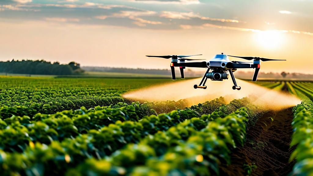
Drone Spraying: Precision Aerial Application
Agricultural drone spraying — the application of pesticides, fungicides, herbicides, or liquid fertilizers directly from drone-mounted spray systems — has grown rapidly from specialty application niche to mainstream commercial practice in several major agricultural markets. In China, agricultural drone spraying accounts for a substantial and growing fraction of crop protection applications, driven by the adoption of purpose-built spraying platforms from manufacturers including DJI Agras and XAG. Adoption is accelerating in Southeast Asia, South America, and progressively in North American and European markets as regulatory frameworks for agricultural drone spraying applications mature.
Compared to ground-based spray equipment, drone spraying offers several distinct advantages for specific application scenarios. For paddy rice fields that are flooded during the growing season, ground-based sprayers cannot access the field without causing crop damage; drone spraying provides effective application access to crops that ground equipment cannot reach. For tree crops — orchards, vineyards, plantations — drones can provide superior canopy penetration for fungicide applications compared to conventional air blast sprayers, with more precise targeting and reduced drift outside the crop area.
The payload capacity and flight endurance of current agricultural spraying drones limits them to fields of manageable size when operating as standalone systems — typical commercial platforms carry 10–40 liters of payload, covering 10–15 acres per load at standard application rates. For large-scale operations, coordinated swarms of spraying drones operating simultaneously, with automated return-to-base refilling cycles, can achieve coverage rates competitive with conventional ground sprayers while preserving the targeting precision and field access advantages that make drone application valuable.
Livestock and Range Monitoring
Precision agriculture drone applications extend beyond crop production to livestock operations and range management. Thermal-equipped drones can locate and count livestock across extensive range and pasture areas rapidly — a task that traditionally required helicopter surveys or ATV-based counts. Automated livestock counting algorithms applied to aerial imagery can generate accurate census data for large herds in a fraction of the time required for manual counting, enabling more frequent monitoring that supports better animal health management and more accurate inventory records.
Drone-based pasture assessment — mapping pasture biomass, species composition, and condition across grazing areas — enables evidence-based rotational grazing management that optimizes livestock production while avoiding the overgrazing that degrades pasture productivity over time. Multispectral drone surveys of pasture areas produce biomass estimates and vegetation condition maps that inform stocking rate decisions and grazing rotation scheduling, providing the spatial data needed for management-intensive grazing systems to operate at the scale and frequency their performance potential requires.
Integration with Farm Management Information Systems
The value of drone data in precision agriculture is realized when it is integrated with the broader data ecosystem that modern commercial farms manage — soil sampling data, yield maps, weather records, application logs, and equipment telematics. Data interoperability between drone processing platforms and farm management information systems (FMIS) enables agronomic analysis that draws on multiple data layers simultaneously, providing contextual interpretation that single-source data analysis cannot achieve.
Standard data exchange formats including the ISOXML standard for farm operation data, GeoTIFF for raster map data, and the emerging Agricultural Data Application Programming Toolkit (ADAPT) enable data portability between drone platforms, precision application equipment, and FMIS software. Enterprise farm operations should prioritize platform selection that supports these interoperability standards rather than proprietary data silos that limit integration flexibility and create lock-in to specific vendor ecosystems.
Key Takeaways
- Multispectral drone mapping with NDVI and complementary indices provides field-scale crop health assessment at 3–10cm resolution for precision management
- Variable-rate prescription maps from drone data can reduce nitrogen application 15–25% while maintaining yield, generating direct input cost savings that exceed drone program costs
- Agricultural drone spraying provides access, canopy penetration, and targeting advantages for paddy, orchard, and high-value specialty crop applications
- Livestock monitoring applications include thermal-based animal location, automated counting, and pasture condition assessment for grazing management
- FMIS integration and interoperability standards are critical for realizing the full analytical value of drone data within broader farm data ecosystems
- Coordinated drone swarms enable spraying coverage rates at commercial field scale that single-drone systems cannot match
Conclusion
Precision agriculture drone technology has progressed from experimental tool to commercial practice across a widening range of crop types, geographic markets, and application categories. The economics of agricultural drone programs are now compelling for many commercial operations — the combination of declining hardware costs, improving analytical software, and documented return on investment cases in major crop types has moved drone adoption beyond early adopters into the commercial mainstream.
The farms that will benefit most from the continued evolution of these technologies are those that approach drone adoption as a data strategy investment — building the analytical capabilities, FMIS integrations, and agronomic expertise needed to translate aerial sensing data into operational management decisions — rather than viewing drone technology as a standalone tool. The data that precision drone programs generate becomes more valuable over time as multi-year datasets enable trend analysis and predictive modeling that single-season snapshots cannot support.